Lithospheric Source
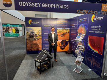
At Odyssey Geophysics, we specialise in
ambient seismic exploration across all scales. We have over a
decade of continent-scale field expertise in the world's toughest conditions. From our R&D
lab in Tasmania, we have developed
smart seismic systems and
cloud software that enable us to capture the highest-quality, near real-time data from the most remote regions of the planet. The massive volumes of data allow us to investigate the Earth in extreme detail,
driving scientific discovery.
Understanding mineral systems requires investigation across all scales. Our approach is to start with Lithospheric Source to understand fertility, focus into Regional Structural Corridors, then tighten to Deposit Targeting - an integrated ambient-seismic workflow designed to target, prioritise, and de-risk drilling.
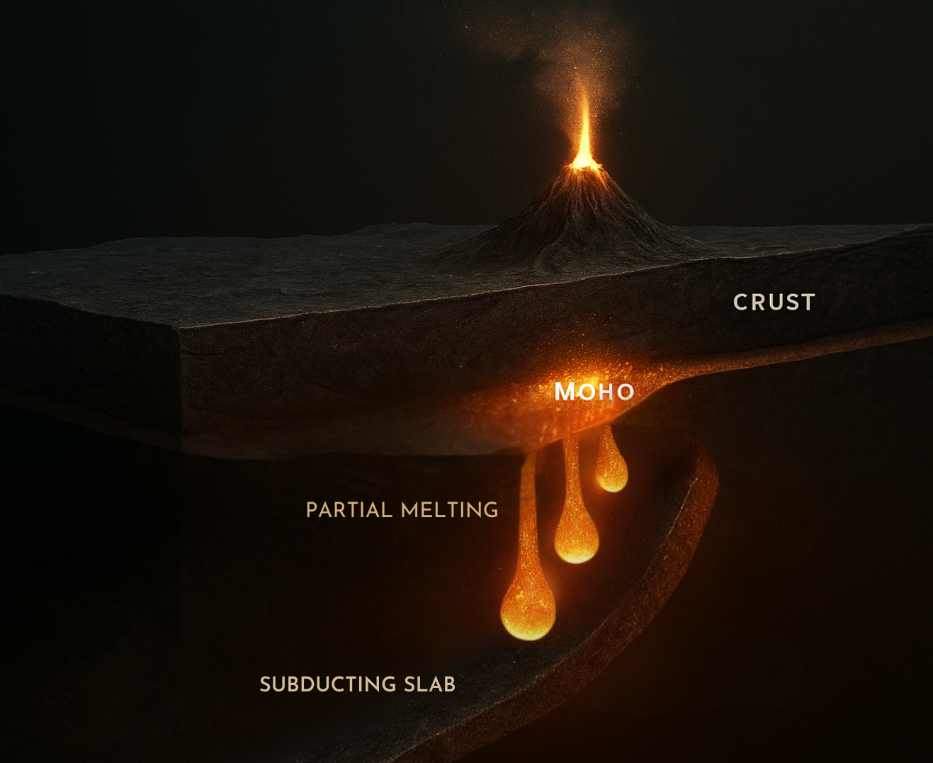
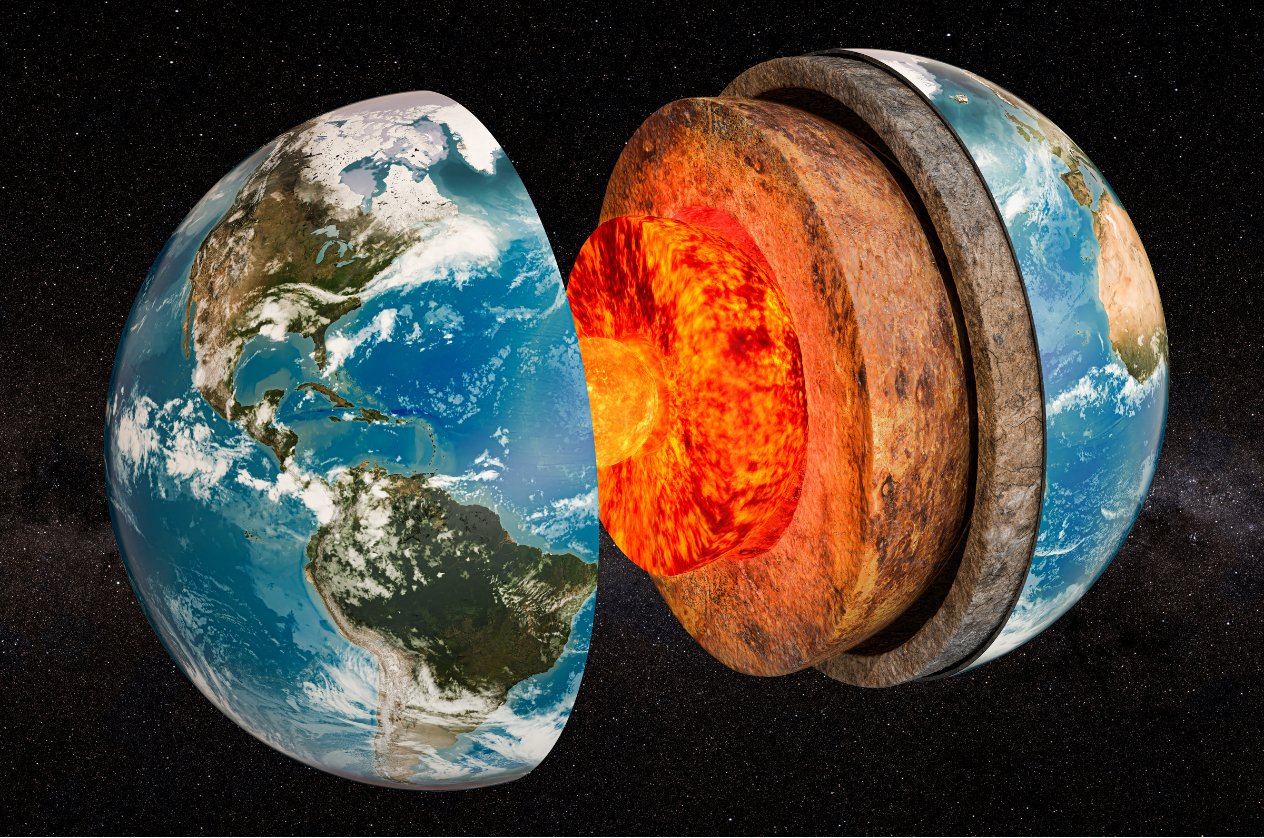
The biggest determinant of “why here?” is the deep crustal and lithospheric framework
Thickened crust, Moho offsets, delaminated roots and reworked craton margins all point to long-lived plumbing systems that control heat, fluids and metal budgets. Using a systems view at continental scale lets us rank provinces under cover before committing to detailed work, turning information on the deep architecture into a pre-competitive fertility screen.
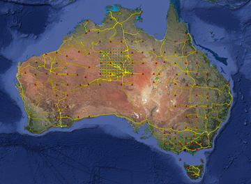
Unlocking potential with ambient seismic exploration
National-scale arrays of broadband sensors facilitate full-crustal investigation. Seismic techniques such as Ambient Noise Tomography (ANT), Receiver Functions (RF), and teleseismic body-wave tomography pair with long-period Magnetotelluric (MT) to deliver a coherent lithospheric context for focusing into the Regional Scale.
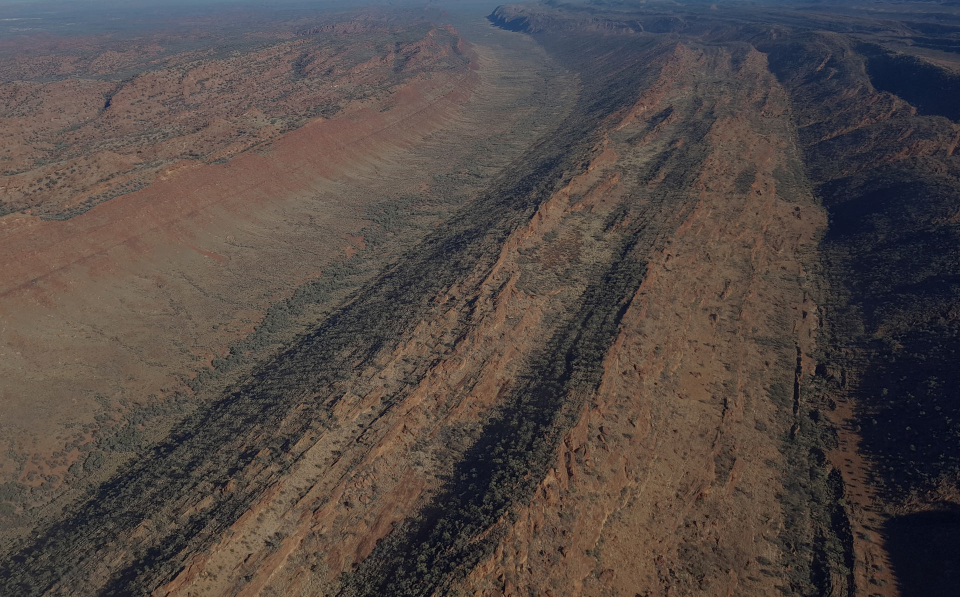
Corridors focus heat, fluids and metals
Within fertile provinces, long-lived faults, basin margins and intrusive centres form structural fairways — the plumbing that moves energy and material through the crust. A mineral-systems workflow ranks these corridors first, shrinking the search space and lifting odds before detailed spend.
How ambient seismic helps
Regional ANT(~5–30 s) resolves basement architecture and depth-to-basement trends; SPAC arrays and HVSR map cover thickness and shallow velocity layering. Co-interpret with gravity and magnetics to delineate and rank corridors for follow-up.
From corridors to drill-ready volumes
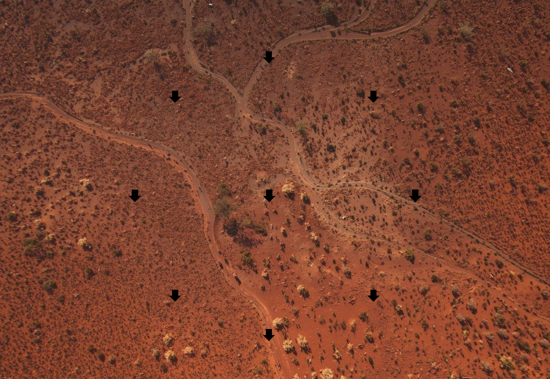
At prospect scale, dense ambient arrays image 3D velocity contrasts tied to structure, rheology and alteration. Our approach is to utilise ambient seismic datasets to test hypotheses and to target, prioritise and de-risk drilling and further exploration.
How ambient seismic helps
High-density, short-period ANT(~0.5–5 s) for 3D Vs models; HVSR for rapid cover screening; local SPAC for shallow Vs — integrated with gravity, magnetics, and geology to converge on drill targets.
from
Argus (/ˈɑːrɡəs/) – ‘all-seeing’
- a sensor system
attuned to the Earth's geophysical rhythms
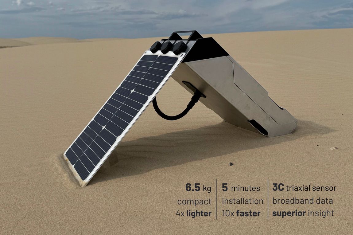
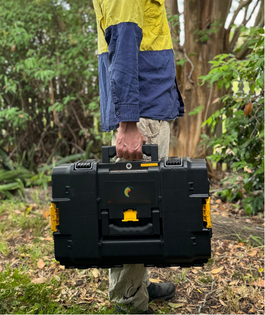


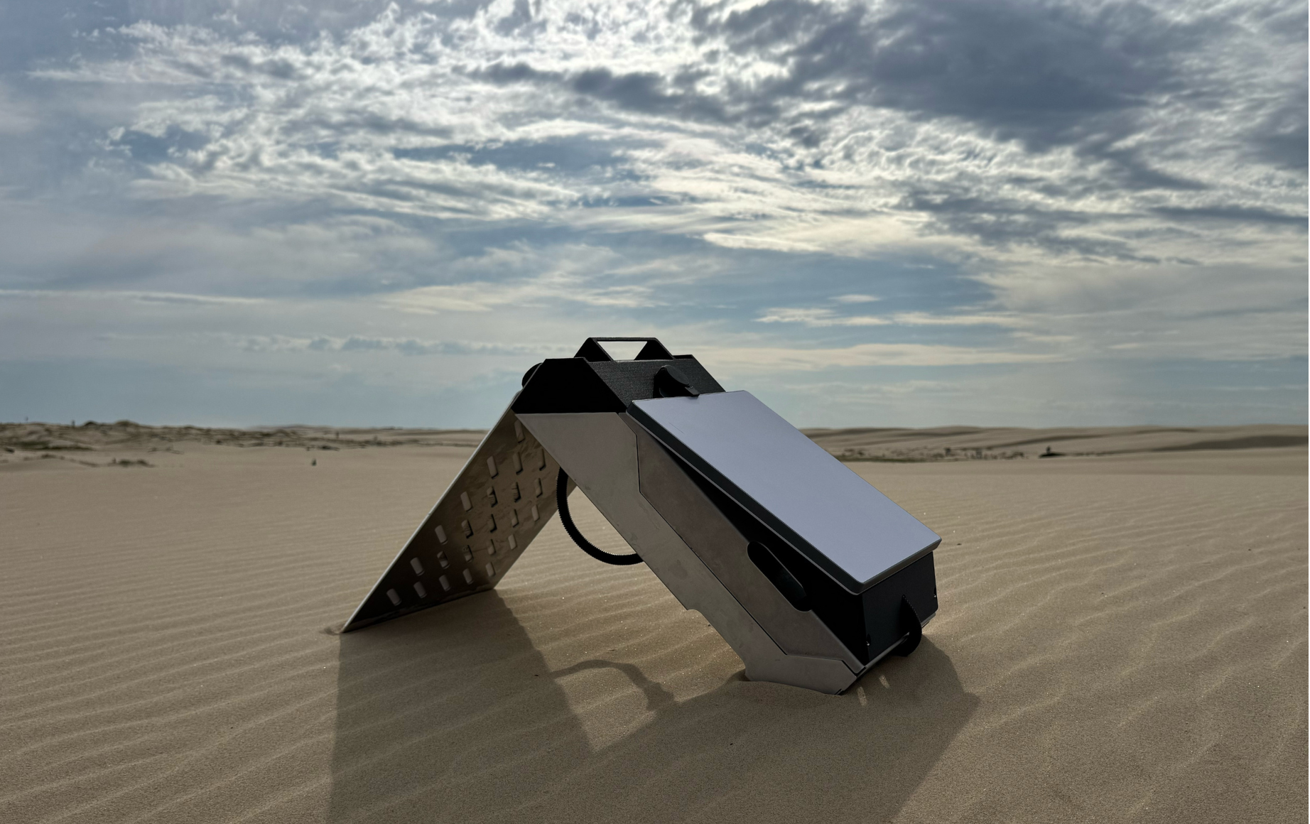
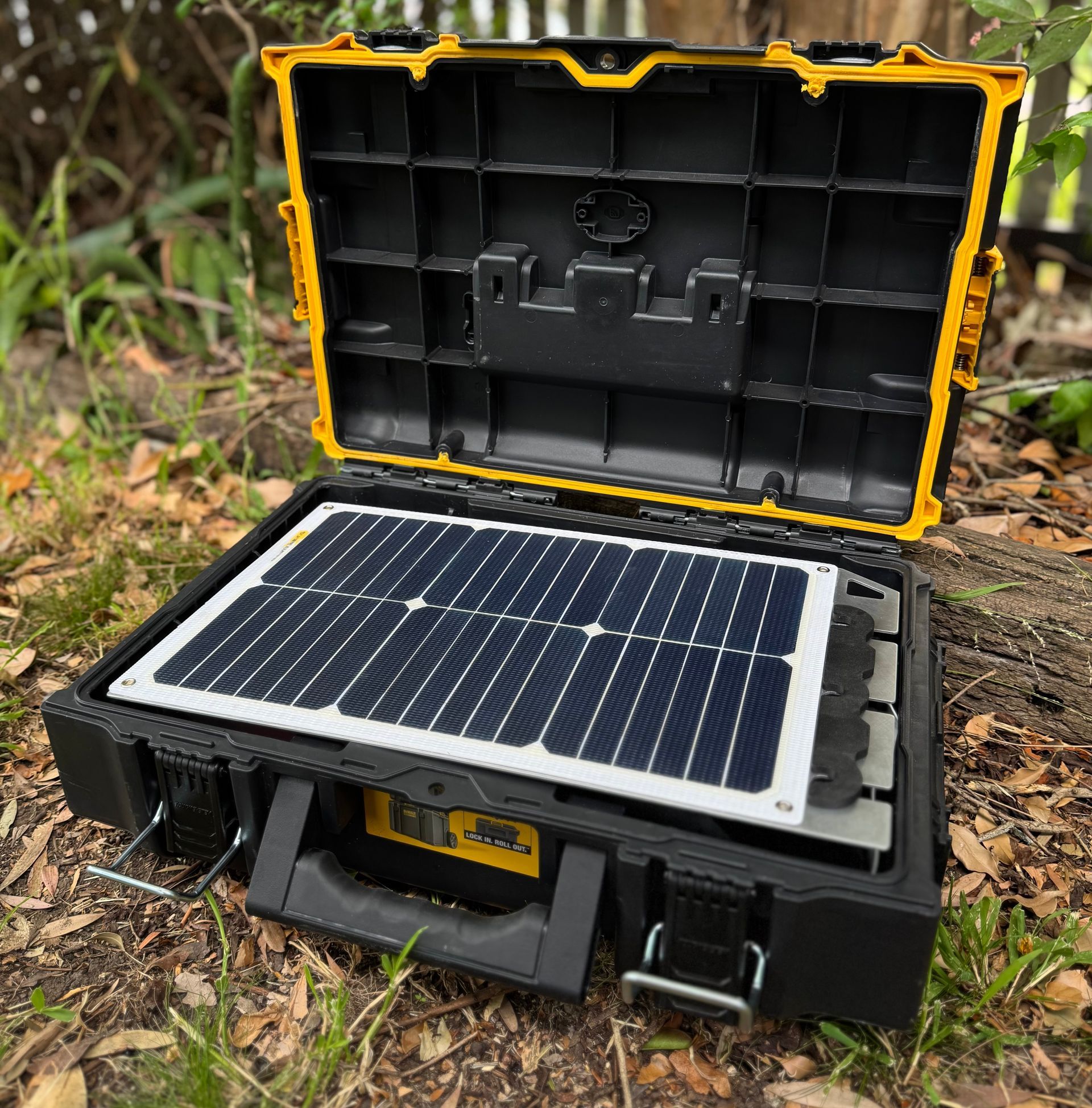
Our node is built to go anywhere you do—it's roughly 4× lighter than existing broadband systems thanks to a ground-up, integrated design that removes boxes, brackets and bulk. The full base kit packs into a rugged, IP67-rated DeWalt case and weighs about 6.5 kg (sensor-dependent), so you can carry it by hand, toss it in a ute, or stack several in the back of a helicopter. Even the flat 20 W solar panel slides neatly into the case.
Under the hood, every gram earns its keep: a stainless-steel 316L housing and high-temperature carbon-fiber-reinforced polymers (PAHT-CF and PPS-CF) protect the electronics; the compact LFP power module keeps weight low and safety high; and the transport case itself is just 1.5 kg. Panel ~1 kg, housing ~1.8 kg—the system is engineered for field practicality without compromise. That tightly integrated approach is how we deliver big-system performance in a small, go-anywhere package.
Drill, drop, and go. With a handheld battery auger and our custom posthole sensor, installs take under 5 minutes—10× faster than existing systems. It’s quick, clean and reliable even when the thermometer hits 50 °C.
With single-button control, GNSS timing acquires in 1–3 minutes (cold start), recording auto-alternates to dual SD cards, and power is standard USB-C PD. Set, level, confirm and roll to the next location.
Built and tested for Australian extremes. Our systems have operated through multiple bushfire events, coping with heat, ash and sudden weather shifts while maintaining recording integrity. Enclosures, vents and seals are chosen for thermal stability and dust ingress protection.
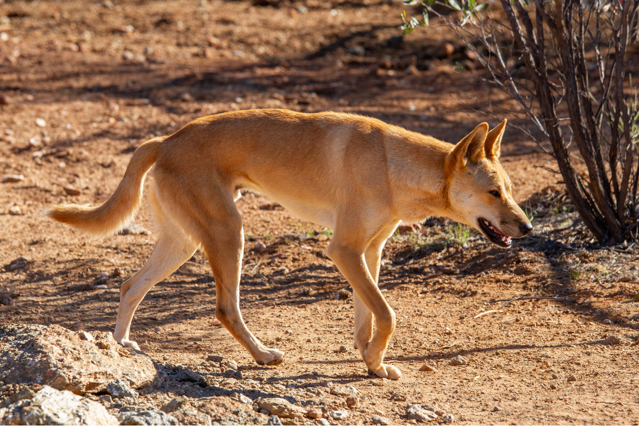
Wildlife-proofing is standard: tamper-resistant lids, robust housings and chew-resistant cable sheathing stand up to curious dingoes, stock and other fauna. Mounting options keep gear low-profile and secure to the ground.
We also field-tested in Tasmania under minimal sunlight conditions. Smart power budgeting and buffered storage keep uptime high during prolonged cloud cover, with health telemetry making it easy to plan opportunistic maintenance if needed.
Start with the right instrument for the job. We support broadband seismometers from multiple vendors, so you can match response, bandwidth and dynamic range to your geology and objectives. Our thin, rugged posthole format drills into soil or rock in seconds for tight coupling and lower self-noise—delivering the highest-quality data. And because we use broadband three-component (3C) sensors, we capture the full wavefield, letting you investigate targets across all scales—from shallow near-surface features to basin and crustal structure.
At the core is a precision 24-bit digitiser with GNSS-disciplined timing and an integrated layout that’s essentially impossible to cable incorrectly. Data are written locally with redundant dual-SD cards and can stream in near real time. Setup stays simple for non-specialists, and any residual sensor orientation issues are automatically detected by Eidosio and corrected during processing.
See progress in near real time. A satellite transceiver backpack moves data off-site on a regular schedule, while a low-power satellite state-of-health link reports essentials—battery status, charge rate, GNSS lock and storage—so you always know how each station is performing. Store-and-forward logic protects files during link outages, ensuring nothing is lost.
Your power budget stays intact. The node’s baseline draw is low, and the telemetry path is engineered for lean operation in remote solar deployments. As data arrive, Eidosio auto-ingests, runs instant QA/QC (gap checks, timing, spectral sanity) and refreshes the result pipeline.
from Eidos (/ˈʌɪdɒs/) - ‘essence’ - our platform explores the fundamental nature of time as revealed through the planet’s geophysical pulse.


Ambient Noise Tomography (ANT) turns continuous ambient seismic noise into signal by cross-correlating recordings between stations and extracting surface-wave Green’s functions. These are used to build dispersion curves and tomographic maps of shear-wave velocity.
At exploration scales, ANT is powerful for mapping lateral changes in crustal structure, basin thickness, intrusive centres and major crustal domains - even where active sources and dense refraction surveys are impractical.
In Odyssey workflows, ANT products feed both the regional architecture stage and, in dense deployments, the prospect-scale velocity models that underpin more advanced inversions and multi-physics integration in Eidosio.
HVSR uses the ratio of horizontal to vertical motion in the ambient wavefield to identify fundamental resonance frequencies of the subsurface. Those frequencies are controlled by impedance contrasts and layer thickness, particularly sedimentary cover over basement.
In mineral exploration, HVSR provides fast constraints on cover thickness, velocity contrasts and lateral changes at relatively low cost, and can be deployed as profiles or grids over large areas - including difficult access or environmentally sensitive terrain.
Combined with ANT, SPAC and well control, HVSR curves can be inverted to shear-wave velocity profiles and used to refine depth-to-basement models that are critical for undercover targeting and for constraining joint inversions in Eidosio.
Receiver Functions isolate P-to-S converted phases at subsurface interfaces using teleseismic arrivals recorded on broadband stations. The timing and amplitude of these converted phases reveal depth and impedance contrasts within the crust and upper mantle.
RF studies are particularly valuable for mapping Moho depth, intra-crustal discontinuities and lithosphere–asthenosphere boundaries, all of which underpin the lithospheric context for mineral systems, geothermal plays and geohazard assessments.
For Odyssey, RF analysis ties local exploration programmes back to regional deep structure, helping link deposit-scale targets with the larger-scale geodynamic framework used in Eidosio-based multi-physics modelling.
Full Waveform Inversion (FWI) iteratively updates a subsurface model to minimise the misfit between observed and synthetic seismic waveforms. By using the full waveform - amplitude, phase and travel time - it can recover fine-scale structure that is invisible to simpler methods.
In passive settings, FWI is applied to surface and body waves extracted from long recordings, often using a combination of ambient noise and event-based data. The result is a detailed 2D or 3D shear-wave velocity model around key prospects.
For deep-cover IOCG and basin resource plays, FWI-quality models help constrain fault geometries, intrusive complexes and rheological contrasts that strongly influence fluid flow, alteration and mineralisation, and can be integrated directly into Eidosio’s multi-physics workflows.
SPAC uses the spatial coherence of ambient noise recorded across circular or pseudo-circular arrays to derive surface-wave dispersion curves. These curves are then inverted to obtain shear-wave velocity profiles with depth.
The method is well suited to urban or infrastructure-adjacent environments and to characterising soft sediments, weathered profiles and engineering layers, all using only ambient vibrations.
When combined with HVSR and ANT, SPAC helps lock down near-surface and shallow crustal structure, providing the high-resolution velocity information needed for robust inversion and interpretation at exploration scales, and for engineering or monitoring use cases.

Eidosio is built for multi-physics from the start. It brings ambient seismic (ANT, HVSR, RF, SPAC, FWI) together with gravity and other potential-field and electrical methods (upcoming functionality) inside a joint inversion framework—aligned on a common spatial/temporal frame so results line up instead of living in silos.
We develop cutting-edge inversion in-house, with a focus on hardware-accelerated, gradient-based methods. These deliver faster convergence, better mixing, and are less prone to local minima. A pop-up visualisation presents the posterior sampled with the NUTS (No-U-Turn Sampler) method, enabling fast, gradient-guided exploration of the solution space. The on-page animation is adapted from Chi Feng’s mcmc-demo ( https://github.com/chi-feng/mcmc-demo ).
From geo – “earth” – and log – “record” – GeoLog is our all-in-one field operations platform, bringing live mapping, asset tracking, service logging and site records together in a single, trusted system for everything that happens on the ground.

The all-in-one field operations platform
GeoLog brings every part of your field workflow into one seamless digital environment. Designed for geoscience, engineering, and environmental teams, it replaces paper forms, disconnected spreadsheets, and scattered map files with a single intuitive system. Whether you’re managing assets, logging site data, or tracking crews in the field, GeoLog keeps everything connected — from the first site inspection to the final report.
Built for field crews, designed by field crews
No more clunky data entry or missing information. GeoLog was created for the realities of remote work — with quick, offline-ready forms, real-time syncing once back online, and maps that actually work where you need them most. Each project stays organised by site, giving your team instant access to historical records, asset status, and standard operating procedures.
Reliable. Secure. Scalable.
GeoLog is engineered for professional field operations — scalable across teams, projects, and regions, with enterprise-grade data security and user access control. Whether you’re managing a small regional survey or a national exploration program, GeoLog grows with your operation and keeps your data safe every step of the way.
COMING SOON
– Groundwater and basin mapping
– CO₂ storage and deep subsurface integrity (CCUS)
– Volcanic plumbing and deep magmatic systems
– Earthquake hazard and site response
– Glaciers, ice sheets and permafrost basal conditions
– Large civil and infrastructure projects
– National / pre-competitive geophysics
– Defence applications
Long term continent-array system visits
Broadband systems worth of data processed
of quality broadband data analysed
In house systems and scaling fast